


RENAISSANCE RING: HIKING NEAR FLORENCE
250 kilometres of hiking trails to visit monasteries, convents and castles, plus trails surrounding the cradle of the Renaissance.
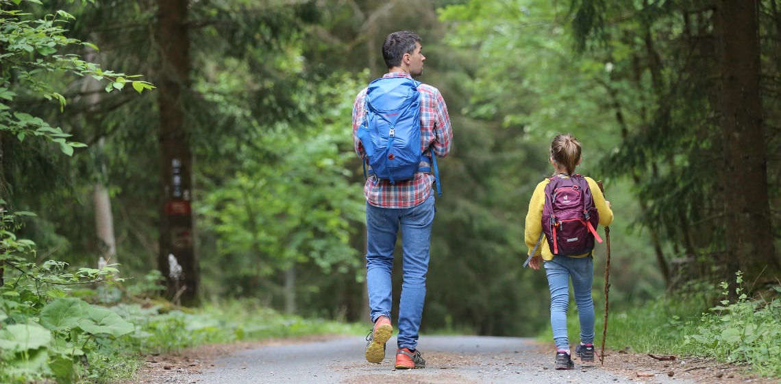
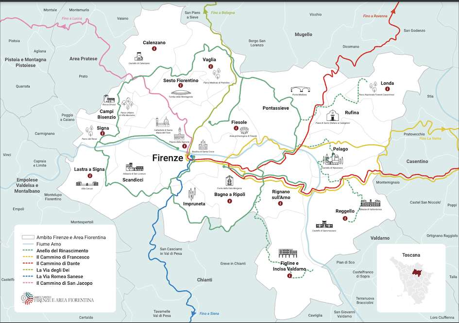
These hiking trails perfectly surround Florence, hence the name the “Renaissance Ring”. The routes, suitable for all, can be walked or tackled by mountain bike (city bikes recommended), and enable active visitors to explore the surroundings of Florence as well as the area’s art, history, nature and scenery. 250 kilometres, to be precise, of roads and gravel tracks, which are divided into stages.
Vertical and horizontal signposting guides and accompanies hikers. Plus, every section, if travelled separately, offers possibilities to reach Florence thanks to public transport connections.
So, it’s up to you to decide how you want to experience the Renaissance Ring. Hike it all, do certain section, one way round or the other!
STAGES OF THE RING
- Calenzano to Vaglia: leaving from Calenzano Castle (the start and finish of the ring), you’ll experience a striking section in terms of nature, especially near to Monte Morello, before reaching Vaglia. (19.7 km / 6.40h)

Photo credits: https://www.castellitoscani.com/calenzano/
- Vaglia – Alberaccio - Fiesole, skirting the Apennines, whose foothills are home to Vaglia and the Montesenario Monastery, with gorgeous views over Florence before reaching Fiesole town centre (23 km/6.40h). The Vaglia-Alberaccio-Santa Brigida variation instead takes you to Poggio Ripaghera, a protected natural area where the centuries-old chestnut grove simply has to be seen (17.5 km/ 3h).
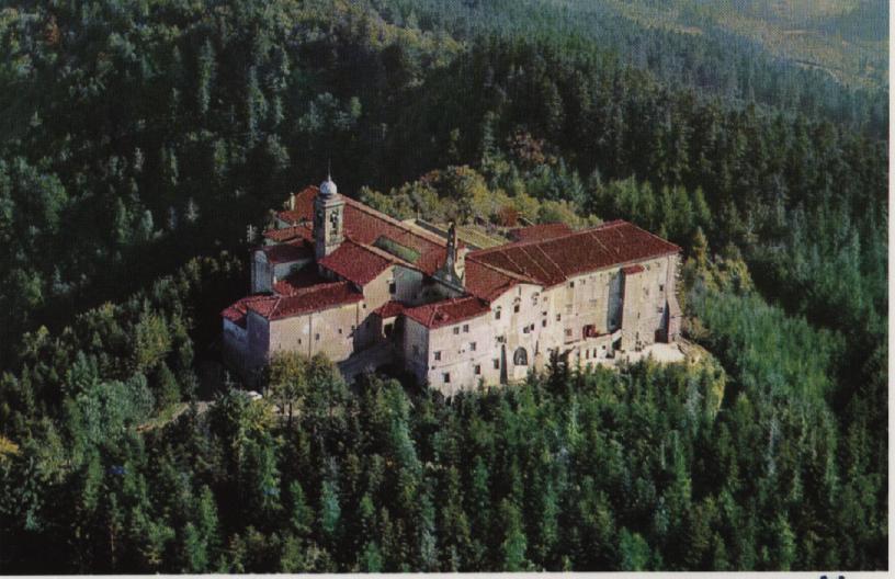
Photo credits: https://citypilgrimblog.wordpress.com/2018/08/29/monte-senario-viaggio-alle-origini-dei-serviti-discovering-the-servite-order-roots/
- Fiesole / Santa Brigida - Pontassieve (13 km/4h), this section heads deep into the Tuscan countryside, with its farmhouses, vineyards and mills, and ends in Pontassieve, whose Madonna del Sasso Sanctuary dates to the 1400s and features a pietra serena altar.
- Pontassieve – Montecucco - San Donato in Collina (13 km / 4.30h), crossing the Valdarno Valley. From Rignano sull’Arno, the hiking starts in Bagno a Ripoli, skirting Montecucco with its extraordinary vineyards (13.5 km / 4h). In this section, you’ll walk along the Via della Maremma, following in the footsteps of pilgrims who once walked as far as Rome.
- San Donato In Collina - Impruneta (18 km/6h) is famous for its woodland, especially the Fonte Santa Park, which, as you can guess from the name, encompasses a fresh and clear water spring.
- Impruneta - La Certosa - Florence, on reaching the Certosa, and heading downhill, you can visit the famous monumental complex that shares the same name as the order (7 km/2h) before arriving in Piazzale Michelangelo and Florence (6 km/2h). On the other hand, from Certosa you can also reach Lastra Signa-Signa via Pian dei Cerri (23 km/6.30h). The Signa-Florence section (12.6 km/3h) passes through the Parco dei Renai, where you can take a dip, and the Parco delle Cascine, and lastly Signa-Campi Bisenzio-Calenzano (16.8 km/4.30h) with all the Florentine plane.
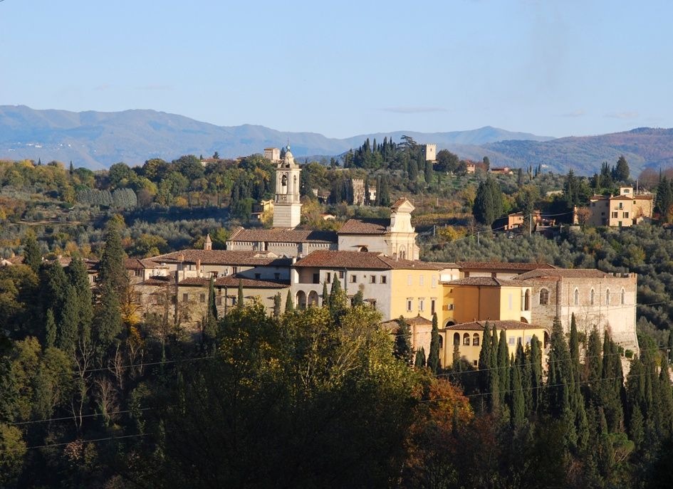
Photo credits: https://it.wikipedia.org/wiki/Certosa_di_Firenze#/media/File:Certosa_del_Galluzzo_-_Overview_from_Le_Gore.jpg
 All the services are provided by local merchants
 By using this site you support Florence
 We offer products with high-quality standards
 You stay sustainable
 It's a 100% trustworthy website